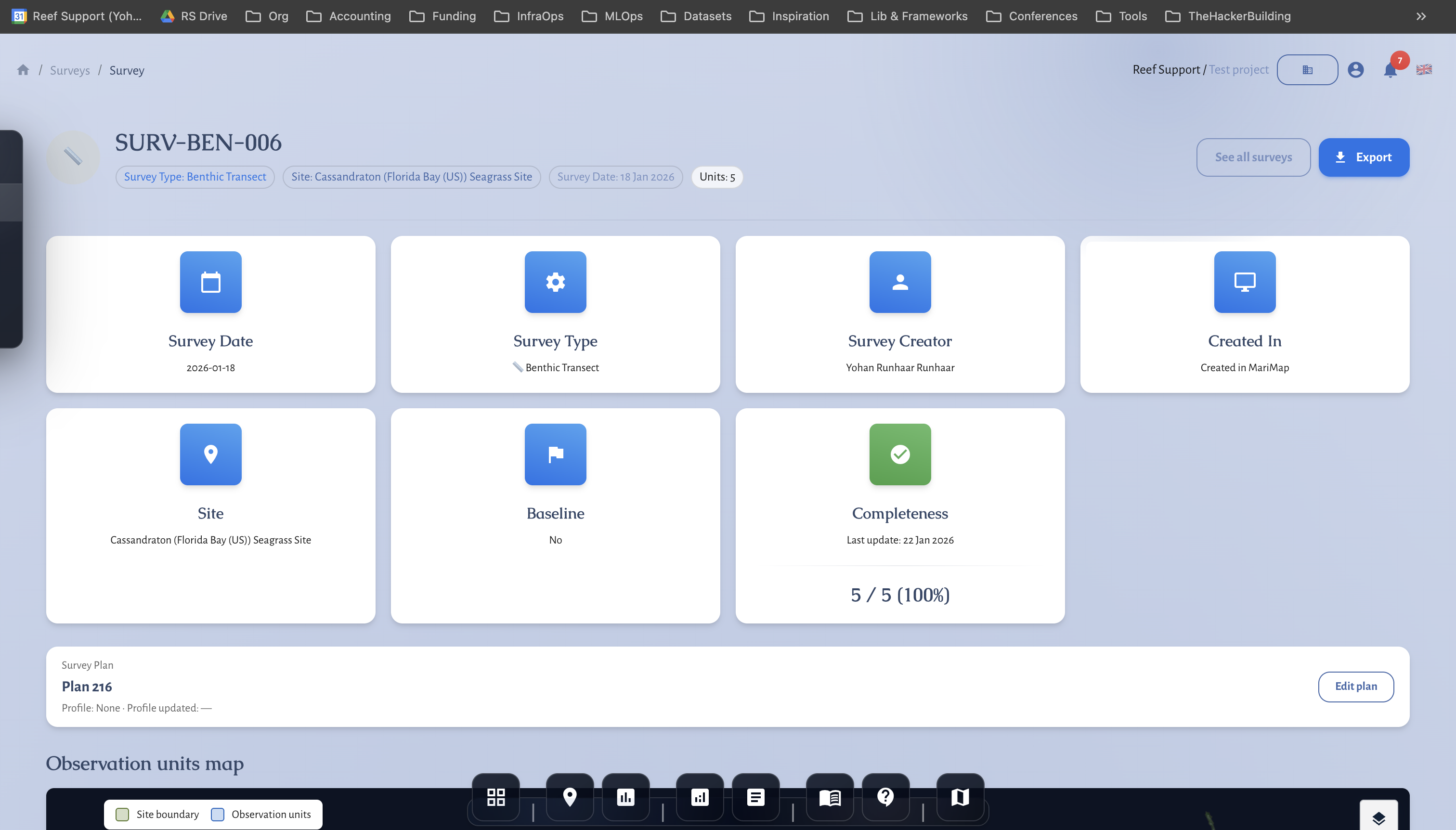
Survey: Benthic Transect
Benthic transect workflows depend on strict consistency in method settings and taxonomic labeling.
Launch the survey
- Start from an approved benthic survey plan.
- Confirm transect geometry and method settings.
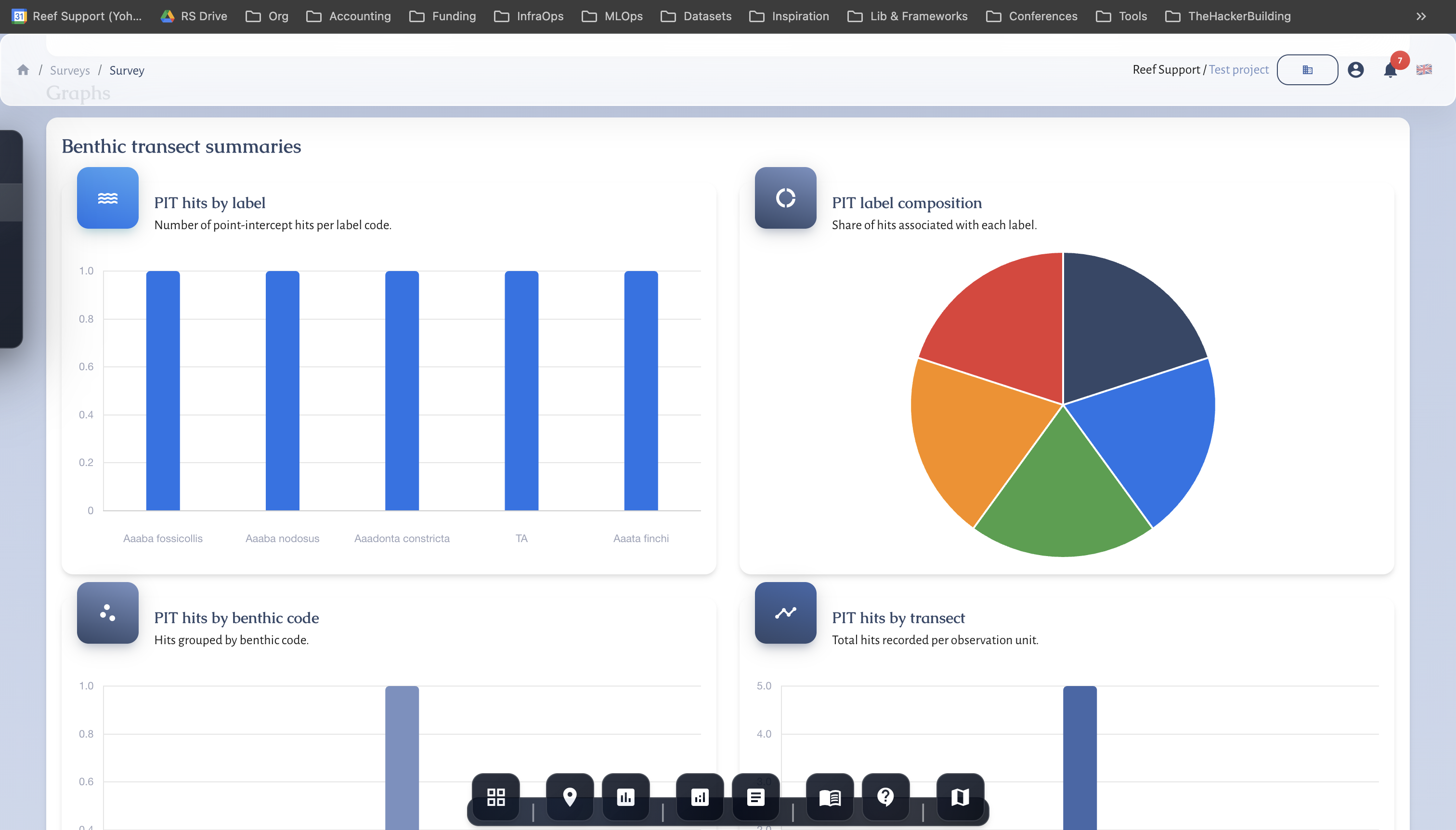
Validate outputs
- Review summary charts after data entry.
- Check category distribution for anomalies.
QA checklist
- Stable taxonomy set
- Correct transect units
- Complete point records
- Peer review before finalization